


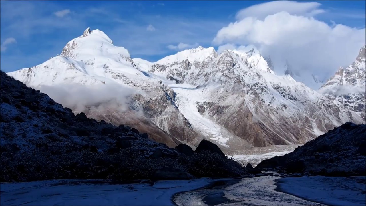
The Panmah Glacier is one of the many remarkable glaciers located in the Karakoram Range, which stretches across the borders of Pakistan, India, and China. Renowned for its stunning yet formidable terrain, the glacier is situated in the remote and rugged northern region of Pakistan, specifically in the Gilgit-Baltistan territory. It is an area known for its high-altitude peaks, including K2, the second-highest mountain in the world. The Panmah Glacier plays a critical role in the local hydrology, ecology, and the region’s overall climate dynamics.
Geographic and Geological Characteristics
Location and Extent: The Panmah Glacier is situated in the Karakoram Range, within the Gilgit-Baltistan region of Pakistan. It lies at a latitude of approximately 35.78°N and a longitude of 76.20°E. The glacier spans an estimated length of 23 kilometers (14 miles) and varies in width between 1.5 to 2.5 kilometers. The glacier is nestled among some of the most formidable peaks of the Karakoram, with elevations ranging from 4,000 to 6,000 meters above sea level.
Geological Composition: The glacier, like many in the Karakoram, is predominantly composed of firn, névé, and glacial ice, which undergoes continuous transformation through the processes of compaction and recrystallization. The bedrock beneath the glacier is primarily composed of metamorphic rocks, including schist and gneiss, along with granitic intrusions, typical of the region’s geological history shaped by the collision of the Indian and Eurasian plates.
Glaciological Features
Mass Balance and Dynamics: The Panmah Glacier, in line with the Karakoram Anomaly, exhibits a relatively stable mass balance compared to other glaciers globally. Its accumulation zone is located at higher elevations where snow accumulates, primarily through winter precipitation. The ablation zone, where melting occurs, is lower down the glacier. The equilibrium line altitude (ELA) on Panmah Glacier, marking the boundary between accumulation and ablation, is typically around 5,200 to 5,500 meters, depending on annual climatic variations.
The glacier’s flow dynamics are influenced by its steep gradient, with velocities recorded in the range of 100 to 150 meters per year in the central flow line. However, the velocities near the glacier’s terminus are significantly lower due to the increased friction with the bedrock and the accumulation of debris.
Crevasses and Icefalls: The glacier features several crevassed zones, particularly in its upper reaches where the ice flow is faster and the gradient steeper. These crevasses can be tens of meters deep, posing significant hazards to mountaineers and researchers. Icefalls are also prominent, particularly where the glacier descends steeply or where tributary glaciers join the main glacier, causing differential ice flow.
Debris Cover: A significant portion of the lower Panmah Glacier is covered by a thick layer of supraglacial debris, composed of rocks, soil, and organic material. This debris originates from the surrounding steep slopes, which frequently experience rockfalls and avalanches. The debris cover acts as an insulating layer, reducing the rate of ice melt beneath it, thereby affecting the glacier’s overall mass balance and dynamics.
Hydrology
Meltwater Contribution: The Panmah Glacier is a critical source of meltwater, contributing to the Braldo River, which eventually feeds into the Indus River. The meltwater discharge is highly seasonal, with peak flows occurring during the summer months when temperatures are highest, and solar radiation is most intense. The glacier’s meltwater is crucial for downstream irrigation, hydroelectric power generation, and as a water supply for local communities.
Glacial Lakes and GLOFs: Several proglacial and supraglacial lakes form periodically near the glacier’s terminus, fed by meltwater and sometimes by calving icebergs. These lakes pose a risk of glacial lake outburst floods (GLOFs), which can result from the sudden breach of natural ice or moraine dams. Monitoring these lakes is essential for early warning systems to mitigate the impact of potential GLOFs.
Monitoring and Research Techniques
Remote Sensing: Due to the challenging terrain and extreme weather conditions, remote sensing techniques are extensively used to monitor the Panmah Glacier. Satellite imagery, including data from Landsat, Sentinel, and TerraSAR-X, provides valuable information on glacier surface velocities, changes in glacier extent, and surface elevation changes. Additionally, Synthetic Aperture Radar (SAR) is used to penetrate through cloud cover and darkness, offering all-weather monitoring capabilities.
In-situ Measurements: Where feasible, in-situ measurements are conducted to gather detailed data on glacier dynamics. This includes the installation of stakes for ablation and accumulation measurements, GPS surveys to track glacier movement, and automatic weather stations (AWS) to record temperature, precipitation, and other meteorological parameters. Ground-penetrating radar (GPR) is also employed to measure ice thickness and bed topography.
Modeling Glacier Dynamics: Numerical models, such as those based on the finite element method, are used to simulate the glacier’s flow dynamics and predict future changes under different climatic scenarios. These models incorporate data from remote sensing and in-situ measurements to improve accuracy. The models help in understanding the glacier’s response to climatic variables and in forecasting its long-term behavior.


