Article
Tirich Mir Glacier: A Jewel of the Hindu Kush


Article
“Preserve your History and Become Everlasting; Receive New life from the Times that have gone by”

The rise of Hindu nationalists in India has rudely brought into focus the two socio-political realities of the post-independent Indian subcontinent; first is that the religion and its based ethos remained the essential elements of the individuals and their group identities overriding other primordial factors like caste-class, language and region. And, second is that the overwhelming numerical majority of the Hindu community and their increasingly un-accommodative attitude in the subcontinent has remained a serious challenge for the autonomous survival and flourishment of the other communities, especially the Indian Muslims, inside as well as outside India, – the South Asian state-system. This article is an attempt to re-visit the pre-partition era in order to understand the logic of Sir Allama Dr. Muhammad Iqbal and Quaid-i-Azam Muhammad Ali Jinnah’s views about the self, the Indian-Muslim, and the other, the majority Hindu community. Their definition of the self is essential to understand the behavior of the Muslim nationalism in India, the emergence of Pakistan, and will also help explain the later attitude of the Hindu majority towards the Muslims in post-partition India, both under the All India National Congress and now the Bharatiya Janata Party (BJP).
The introduction of Islam in the subcontinent had brought a fundamental change in the socio-cultural fabric of its society. Unlike the other non-Hindu religions of the past, Islam refused to merge into the old traditions of the Brahmanical religion. Its followers, both outsiders and local converts, captured the political power and governed the subcontinent for over a thousand years. During this period of hegemony, the socio-religious Persian-Arabic traditions of the elite interacted with local traditions and created a distinct Indian-Muslim civilization, Islam-Urdu. This Islam-Urdu civilization created its elite-middle class, especially the middle town gentry that made significant contributions in every aspect of its life, art, literature, music, and architecture of the subcontinent. The Hindu upper-caste gentry did participate in this Islam-Urdu venture but their role was treated as ancillary. The British colonization of India came largely at the expense of this Muslim gentry; in addition to it, the Hindu gentry joined the British-Indian Raj and continued to serve and benefit from the personage of the new state. The Muslim gentry suspected the role of Hindus in their defeats in battles of Plassey under Siraj-ud-Dawla and Seringapatam under Tipu Sultan; after these defeats the Raj in retaliation completely wiped out the Muslim gentry in Bengal. Later, almost the same roles were repeated in the 1857 War of Independence. The Muslim suspicions about the intentions of the Hindus were further increased with the projected ideologies and activities of the Hindu revivalist movements like Brahmo Samaj and Arya Samaj. They were perceived as instruments of the Hindu gentry to unify their community on the cult of Shivaji against the Muslims in India. The numerically strong Hindu gentry was perceived determined to exploit the anti-Muslim sentiments of the British in order to occupy the positions of power and economy in the Raj and fulfill their long-held dream of the revival of Hindu Raj in India. In the light of their experience, the Muslim gentry considered the possibility of any Hindu-dominated political order a serious threat to the survival of the Indian-Muslim community and its Islam-Urdu civilization in India. Moreover, the Raj introduced the institutions of elections for the local bodies and competitive exams for the bureaucratic jobs; these developments further increased the fears of marginalization of the Muslim gentry against 80 percent majority share of the Hindu community compared to their own 13.5 percent share. Therefore, in the post-1857 War of Independence era, the entire Muslim gentry and its leadership were determined to survive as a distinct Indian-Muslim community in the subcontinent through balancing the Hindu majority and avoiding any possibility of the establishment of a Hindu Raj.
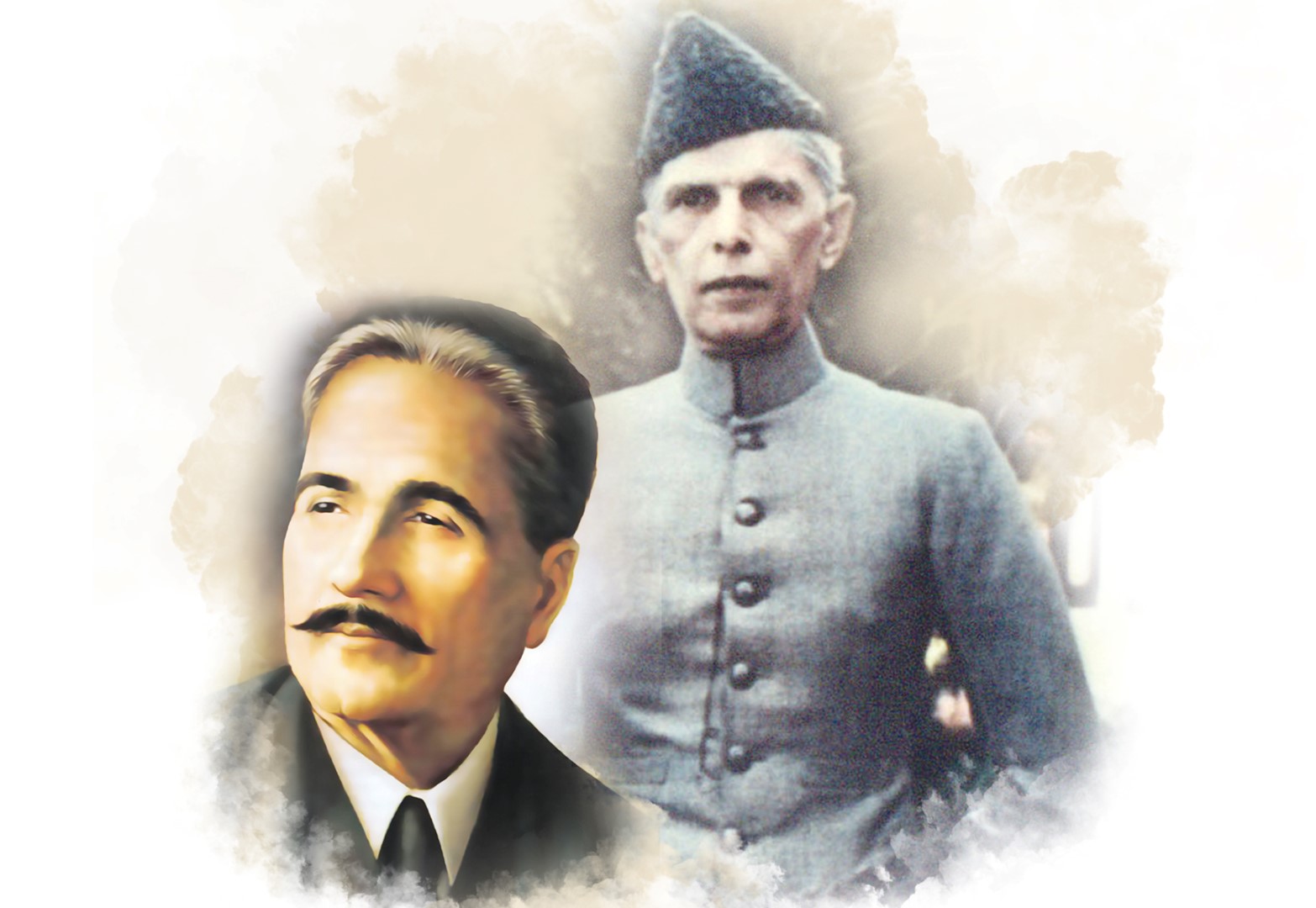
Sir Allama Dr. Muhammad Iqbal was the first leader who understood the dilemma of the Indian Muslims who were caught in between the power of the Raj and its ideas, and the Hindu majority that was not ready to accept them as an equal community. He interpreted the Western concept of democracy and nationalism in order to make them ideologically and practically relevant to the situation in India. In this regards, he started his intellectual journey from the Western concept of romantic Indian nationalism; his famous poem Sāre jahān se acchā, Hindositān hamārā (Better than the entire world, is our Hindustan), reflected his early views. Later, he reconsidered his views and found Western concepts less compatible with the Indian environment that was composed of diverse communal groups. Accordingly, India was an amalgamation of diverse communal units that cut across the regional and linguistic lines. He argued that the democratic system of the Raj had to recognize this reality and reorient itself from its territorial standpoint to the communal units of Indian society. Similarly, he disagreed with the concept of nationalism that he thought were in conflict with the universal and ethical nature of Islam. He was critical of the narrow public focus of the concept of nationalism that had taken religion away from the public to the private sphere. He argued that the Islamic concept of nationalism freed an individual from his geographical limitation and binds him to a universal social order. This universal Islamic social order combines the ethical, legal, and political ideals of Islam. He further argued that throughout history Islam had played a vital role in the lives of Indian Muslims and had provided them essential emotions for the development of mutual loyalties which now bind these scattered individuals and groups into a well-defined people. That is why the Indian Muslims were the most homogeneous and united people in India fit for any definition of a nation in the modern sense of the word. Iqbal argued that the ethical-political social order of Islam encouraged the Muslim community to find internal harmony across various diversities and, simultaneously, negotiate reciprocal communal harmony and cooperation with other communities.
Allama Muhammad Iqbal considered the communal problem between Hindus and Muslims as an international issue because for him the communal groups were nations in their own rights. He thought that issues between Hindu and Muslim communities could only be settled on a reciprocal basis through giving full respect to the customs, laws, religious and social institutions of each other’s communities. That is why he was less enthusiastic for any power-sharing formula based on separate electorates in a unified central legislative, rather he preferred a federal structure in which a community had a right to free development according to its ideals. The 1928 Congress’ rejection of the Lucknow Pact, in which it had accepted the principles of separate electorates, concept of weightage – Muslims should receive more than their demographic share in terms of representation in the Muslim minority provinces – and one-third share in the legislative, through the Nehru Report convinced Allama Muhammad Iqbal that the establishment of a separate region for Indian Muslims was the only way to avert the threat of the Hindu Raj in an independent India. He perceived autonomy through self-government as essential for the survival and self-preservation of the Muslim community and its way of life in India. In this regards, in 1930, at the annual session of the All India Muslim League at Allahabad, he proposed the formation of a Muslim autonomous unit consisted of the Punjab, NWFP, Sindh, and Balochistan within or without the British Empire as the only solution for the communal problem in India. He declared that his proposal was in the best interest of India and Islam because it would provide peace and security to all Indians through establishing an internal communal balance of power. He argued that his proposal would also provide an opportunity to the Indian Muslims to modernize and bring them closer to the original spirit of Islam, their traditions of law, education, and culture.
Like Allama Muhammad Iqbal, Quaid-i-Azam Muhammad Ali Jinnah started his political struggle as an ardent supporter of Indian nationalism. At that time, he disagreed with the efforts of Simla Deputation, a 35-member delegation under the leadership of Sir Aga Khan III, about a separate electorate for the Muslims; on the contrary, he wanted to unify both the communities to have a joint struggle for Home Rule (self-government). He was a liberal democrat and wanted to have a state where all the citizens could live freely and enjoy their religious and social life. In the Lucknow Pact, his proposal for the reservation of one-third representation was for the protection of minority rights in majority provinces and applied to both Hindus and Muslims in their respective majority provinces. His passionate and unbiased work for communal unity earned him the title of the ‘ambassador of Hindu-Muslim unity’. His approach to the communal problem in India was that communities should be defined in socio-religious terms but be treated with political equality and protected through secular constitutional power-sharing formula. But, the narrow-minded and violent Hindu communalists confronted his approach; Mohandas Karamchand Gandhi initiated the process, he wanted to use religion for the mass mobilization of the Hindu community. In the 1920 annual session of the Congress at Nagpur, the gradual and constitutional political approach of Jinnah was rejected, and ‘Mahatma’s approach of religious mass mobilization for the attainment of swaraj (independence) was adopted. This religio-political approach for mass mobilization resulted in a decade of communal Hindu-Muslim violence instigated by the aggressive-violent campaign of Shuddhi and Sangathan movements against the ordinary Muslim masses. Jinnah still wanted to have a Hindu-Muslim concord; in 1928, he offered the Congress that the Muslims were ready to give up the separate electorates in return for the reservation of one-third of seats in the Central Assembly. The Congress rejected his proposal; later, its two claimed moderated leaders Motilal Nehru and Tej Bahadur Sapru, in their Nehru Report, went back on all the previously accepted promises of the constitutional protection for the Muslim minority. The All India Muslim League rejected the report and Jinnah presented his charter of 14 Points with the demands of a federal form of government and separate electorates for the minorities. In 1937, the Congress again betrayed the Indian Muslims and Jinnah, in the formation of the provincial government in United Provinces (UP-present-day Uttar Pradesh and Uttarakhand). Despite an informal pre-election alliance, it refused to form a government with the Muslim League and formed a Hindu majority government in the province; its UP Legislative Party had only two Muslim legislators. This compelled Jinnah to declare categorically that he believed in a Hindu-Muslim pact but it could not be achieved at the destruction of one and survival of the other.
The 1937 Hindu majority provincial governments of the Congress convinced Jinnah and the Muslim community that after the British withdraw, no constitutional arrangement could safeguard them against the emergence of a permanent Hindu majority and conversion of the Indian Muslims into a permanent minority. In such a Hindu majoritarian system, the Indian Muslims would be completely shut out of power and would be forced to live as a helpless minority. At this historical juncture, Allama Iqbal advised Jinnah that in a Hindu majority state, the enforcement and development of the Shariat (Islamic way of life) of Islam was not possible and that Islam and Muslims could only flourish in a free state. Furthermore, an independent Muslim state was essential for the economic prosperity and peace in India. The demand for self-preservation, fear of the establishment of a destructive Hindu Raj, and desire for participation in the processes of modernization were the basic elements of the context in which the Indian Muslim nationalism took its final shape. Pakistan emerged as a consensus of the entire Muslim community of the Raj both in the minority and majority provinces. Jinnah declared that the Muslims of India were not merely a religious community rather a nation with their distinct way of life, history, culture, and civilization. Therefore, the Hindu-Muslim problem was not communal rather national and it could only be settled based on the principle of sovereign equality for both the Hindu and Muslim nations. On August 11, 1947, in his first speech to the Constituent Assembly of Pakistan, presided by Jogendra Nath Mandal, Jinnah, as the Governor-General of Pakistan, reiterated his constitutional approach to religious matters, he declared religious freedom and political equality for all citizens of Pakistan irrespective of their faith.
The evolution of post-independence India from secular-Hindu-majoritarianism to explicitly Hindu-majoritarianism justified the foresightedness of the forefathers of Pakistan. Despite its secular claims, the Indian state and society remained susceptible to a communal discourse of its political leadership. The Indian political elite used the rhetoric of secularism to mobilize the Indian Muslim minority for electoral purposes while they continued to suspect their loyalty to the new state of India as potential citizens of Pakistan. Minister of Home Affairs Vallabhbhai Jhaverbhai Patel actively participated in the rebuilding activities of the Somnath Temple as a symbol of the Hindu political revival. Additionally, he removed all Muslim officers from important positions in his ministry. The Indian Muslim community faced similar communal attitudes in other fields as well; most of their energies were wasted in the preservation of their symbols of identity, such as the Urdu language, the Muslim Personal Law, the Aligarh Muslim University (AMU), and Article 370 of the constitution that attempted to ensure the Muslim majority status of the state of Jammu and Kashmir. Their population was 13.5 percent but their representation in the Lok Sabha was around 2 to 6 percent; an almost similar decline was witnessed in other aspects of Indian national life from education to government jobs. Thus, long before the rise of Hindu nationalism, the political marginalization and the socio-economic ghettoization of the Indian Muslim community were completed. The rise of BJP has further increased their socio-political irrelevance to the Indian national life. At present, there are only 22 Muslim Members of Parliament (MPs) in 545 members of Lok Sabha; around 14 states have not elected even a single Muslim MP in the last 25 years. In this hostile environment, the Indian Muslims had failed to protect essential elements of their community’s identity like Article 370 and the Babri Masjid. The Muslim Personal Law was amended without the consent of the community. With the passage of the Citizenship (Amendment) Act of 2019, Indian Muslims are now facing the real possibility of becoming second-class citizens in their own country.
In this Hindu Raj, Indian Muslims are being repeatedly told that they are a minority and their community’s memories, artifacts, architecture, and culture are not a part of the Hindu nation. On the protest of Vishwa Hindu Parishad (VHP), Furqan Ali, a headmaster of a government primary school in Pilibhit district of Uttar Pradesh, was suspended because his students recited a poem written by Allama Iqbal, “Lab pe aati hai dua ban kay tamana meri” (May longing come to my lips as supplication of mine O Allah!). Similarly, the Sangh Parivar had demanded from the Aligarh Muslim University to remove the portrait of Muhammad Ali Jinnah from the walls of its student union office where it was hung for the last eight decades, since Jinnah was an honorary member of the students’ union.

DR. MUHAMMAD MUJEEB AFZAL
The writer is on the faculty of Quaid-i-Azam University (School of Politics and International Relations).

Pakistan Successfully Launches PRSE-EO2 Satellite into Space

Balochistan and the New Battlefield: Diamond Cuts Diamond

Kashmir Day: A Voice for Dignity, Peace, and Justice